Introduction
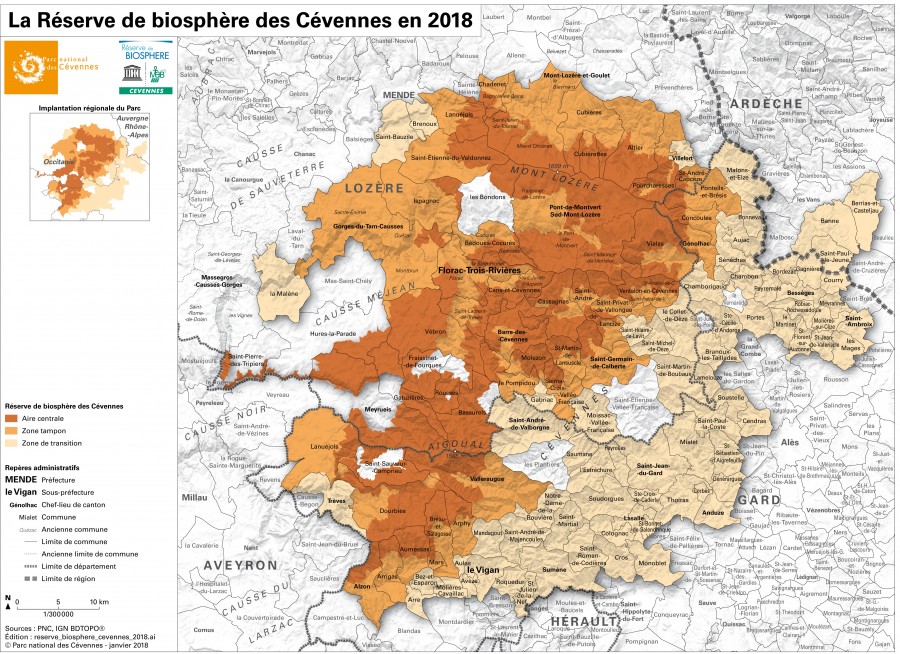
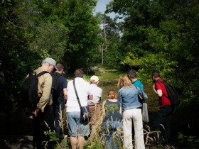
The Cévennes National Park/Biosphere Reserve, located south of the Massif Central, extends over the departments of Lozère, Gard and Ardèche. A medium mountain territory, it's a region of four geographical entities: the Aigoual massif, the Méjean plateau with the Tarn and Jonte canyons, the Mount Lozère and the Cévennes valleys. The climate, altitude and geology, which are highly contrasted, have influenced the location and activities of man, architecture, landscapes, vegetation and wildlife in each of these four massifs.
 The richness of this territory is based on a magnificent mosaic of natural environments that shelter an exceptional biodiversity, with 2,400 animal species, 2,300 species of flowering plants and ferns, as well as countless mosses, lichens, mushrooms...
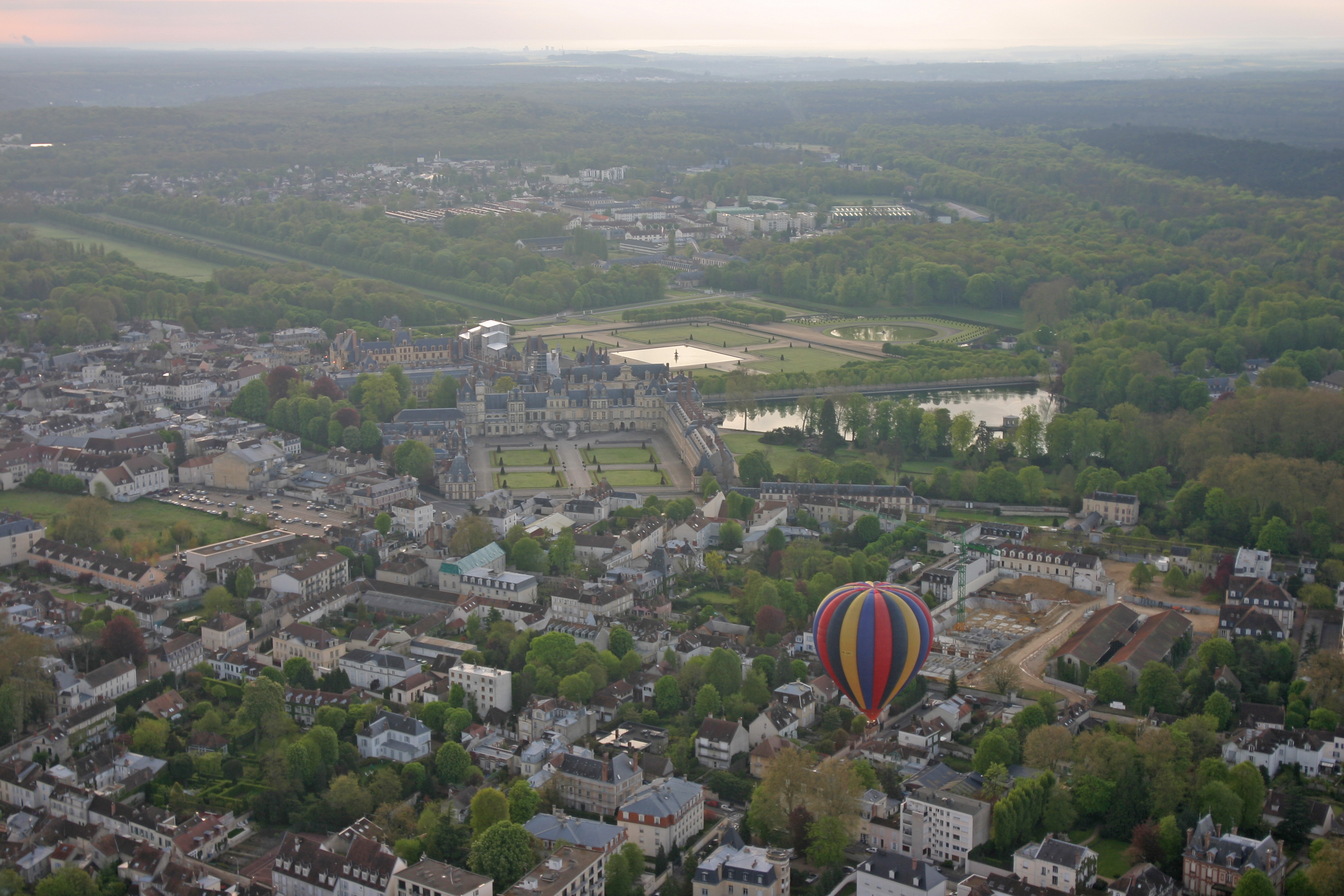
Located 60 kilometres south of Paris, the Biosphere Reserve comprises three major areas: a large western half dominated by agriculture, the emblematic Fontainebleau forest in the centre, and the Val de Seine in the east. The region's forest and remarkable cultural heritage, including the Château de Fontainebleau, a UNESCO World Heritage Site, attract millions of visitors every year.
 The territory is home to a high level of biodiversity (about 5,000 plant species and 6,600 known animal species) and diversified habitats: humid moors, limestone meadows, ravine forests, peat bogs, ancient woodlands and beech forests, typical sandstone plains... linked to the diversity of the soils and the geographical location of the territory and its various climatic influences.
Landscapes have been shaped by human activities such as forestry, agriculture and mineral resource extraction. Other activities, such as tourism, nature sports, hunting and fishing, make this Biosphere Reserve a place of intense exchange between people and nature.
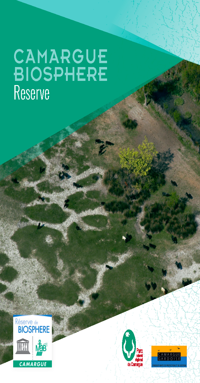
Between the Rhône River and the Mediterranean Sea, the Camargue Biosphere Reserve covers the entire biogeographical delta of the Rhône, since its revision in 2006. An immense natural area, located between two very densely populated regions at the gates of the agglomerations of Montpellier, Nîmes, Arles and Marseille and the industrial site of Fos-sur-Mer.
An essentially horizontal landscape, the Camargue nevertheless has many bulges that are sources of diversity: alluvial bulges of the old and current branches of the Rhône and dune ridges created by the marine currents and historical shorelines of the Mediterranean Sea. Between these areas, which are still partly forested, in the depressions, there are lowlands occupied by lagoons bordered by salt steppes, reed marshes partly used for reed cutting and ponds - the largest of which, the Vaccarès, covers 6,500 hectares.
The salt content of the soil and water, the wide variations in flood conditions and the vagaries of the Mediterranean climate determine the biological richness of the Rhone delta.
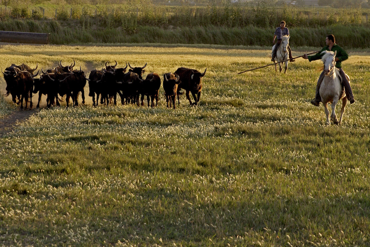 The agricultural landscapes of the Camargue are composed of wet meadows and sansouïres dedicated to the breeding of bulls and horses, former marshes converted into rice fields, lagoons developed for salt exploitation and market gardening and viticulture on the dunes. The hydraulic mesh necessary for this agriculture is omnipresent. It influences the management of these agricultural areas and indirectly that of adjacent natural environments.
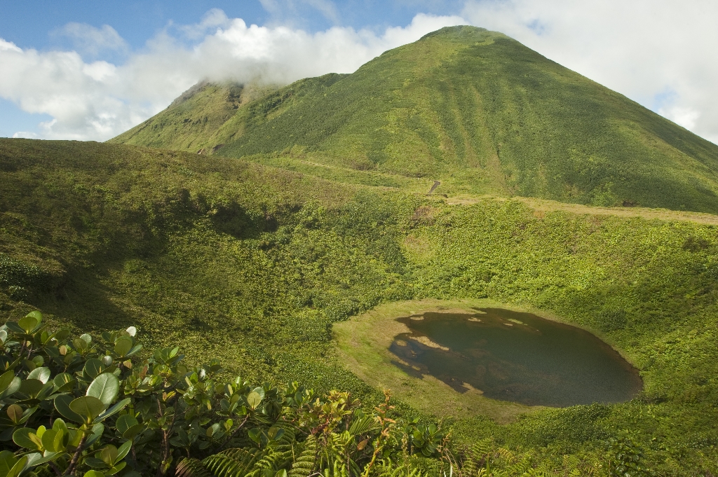
The Fangu Valley Biosphere Reserve includes the watershed of Fangu, a mountain stream flowing into the Gulf of Galeria in Corsica. It extends from the Mediterranean Sea to an altitude of 2,556 metres, offering all the intermediate layers of a Mediterranean valley.
Human activity is very discreet with 450 inhabitants spread over different hamlets in the municipalities of Galeria, Manso and Calenzana. The economy is essentially based on livestock farming, local products and summer tourism concentrated on the coast and shores of Fango. Controlling tourist numbers is one of the major challenges, with the need to extend the season by diversifying tourist products and managing the impact of visitors on the most frequented areas, such as the Fango swimming areas and its estuary.
Discover the vallée du Fango Biosphere Reserve and download the information leaflet.
The women and men of this territory have always lived on the same resources, drawing from the rich nature to live and survive, mobilizing its resources and strengths to establish their industries, creating know-how, traditions and legends to live better together and in symbiosis with their land.
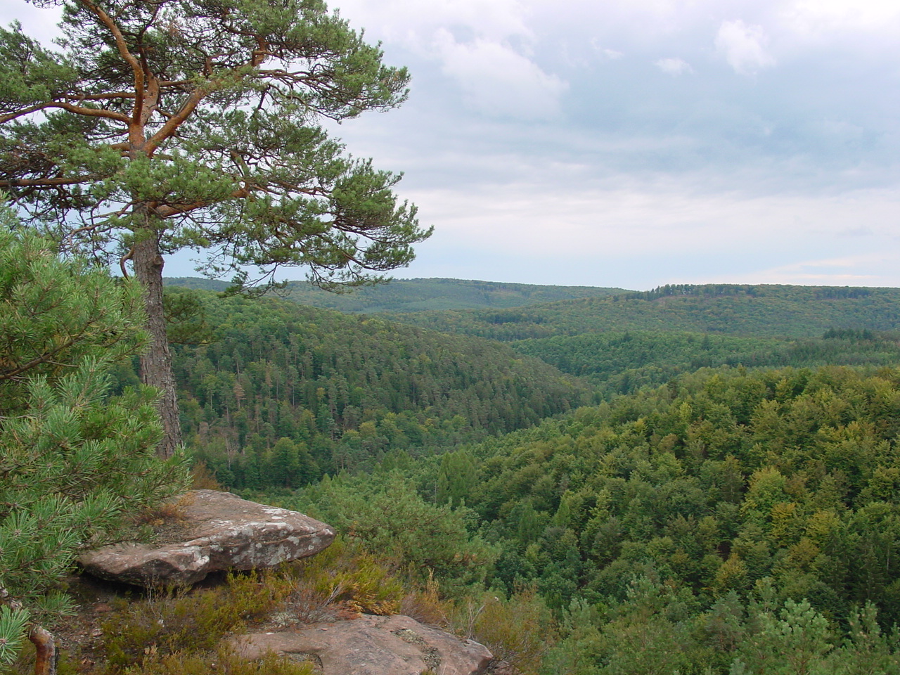 The territory of the Vosges du Nord-Pfälzerwald Transboundary Biosphere Reserve is not only rich in geological and heritage homogeneity. Its richness also comes from the meeting of the ocean and the continent's influences, creating a frontier territory of two climatic forces, whose environments and species, among the most remarkable in Europe, find their distribution limits. More than anywhere else, human history has imposed its breaks. From Celtic hordes to Roman legions, from medieval lords to modern emperors, all the conquerors fought and shared this land, between the Rhine and Moselle. The great European tragedies were written here until the Second World War, the deadliest.
The European idea was built on these ruins and nightmares. How to overcome borders without making war? It is not enough to turn the page on memories. We must also build a future, by recognizing and promoting what unites us: identical landscapes, common heritage resources, languages, cultures and traditions, a common vision of the challenges of the future.
All this establishes the Vosges du Nord-Pfälzerwald Transboundary Biosphere Reserve, a modest and valuable contribution to the great design of Europe and the erasing of an artificial border for the benefit of a restored nature.
On both sides of the border, it is indeed the same sandstone, the same streams, the same forest, sheltering similar natural environments and identical animal and plant species.
In 1997, the Luberon Regional Nature Park, created in 1977, was integrated into the network of Biosphere Reserves. It is bounded to the south and east by the Durance valley, one of the most important rivers in the south-east of the Rhône, which contains wetlands of great interest. This territory is composed of Mediterranean plains and hills irrigated by several rivers with irregular torrential regimes (Calavon, Largue, Lauzon in particular). The east-west facing mountain ranges of Provence, the Luberon Mountains ((1,125 m) and the Monts de Vaucluse (1,256 m), dominate it and are subject to significant alpine influences.
Relations have developed between the actors of this territory and those on the northeast side of the southern slope of the Montagne de Lure (1,826 m), a continuous area with many common characteristics and in particular a strong biological and cultural interest. In 2009, during the periodic review of the Luberon Biosphere Reserve, it became clear that collaboration could be expanded and diversified within the framework of an expanded Biosphere Reserve, an approach that was approved by UNESCO in June 2010.
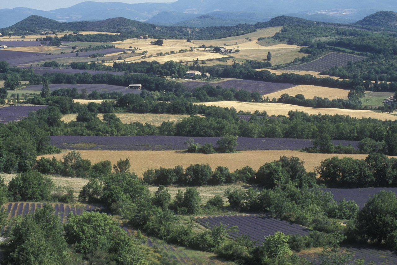 Inhabited for a very long time, this area is known for the interest of its biological and geological heritage. Human history is particularly rich and has left many traces: a high quality built heritage (villages, castles and religious buildings, industrial heritage, vernacular heritage, etc.), but also practices and knowledge still alive, in particular in relation to a varied agriculture (viticulture, arboriculture, cereal growing, market gardening, perfume plants, livestock, particularly sheep).
A real summary from the Alps to the Mediterranean, the Mont Ventoux Biosphere Reserve is organised around the "giant of Provence", characterised by an impressive biological telescoping system. Habitats and species of Mediterranean and Alpine origin are present side by side, due to a high gradient of altitude on the one hand and high contrasts between the southern and northern slopes on the other hand.
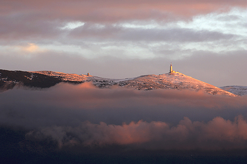 Mont Ventoux is a land of contrasts due to its altitude (1909 m) and its geographical location between the temperate and Mediterranean world. Thus, the massif presents an astonishing diversity of environments, sheltering many plant and animal species, some of which are truly rare.
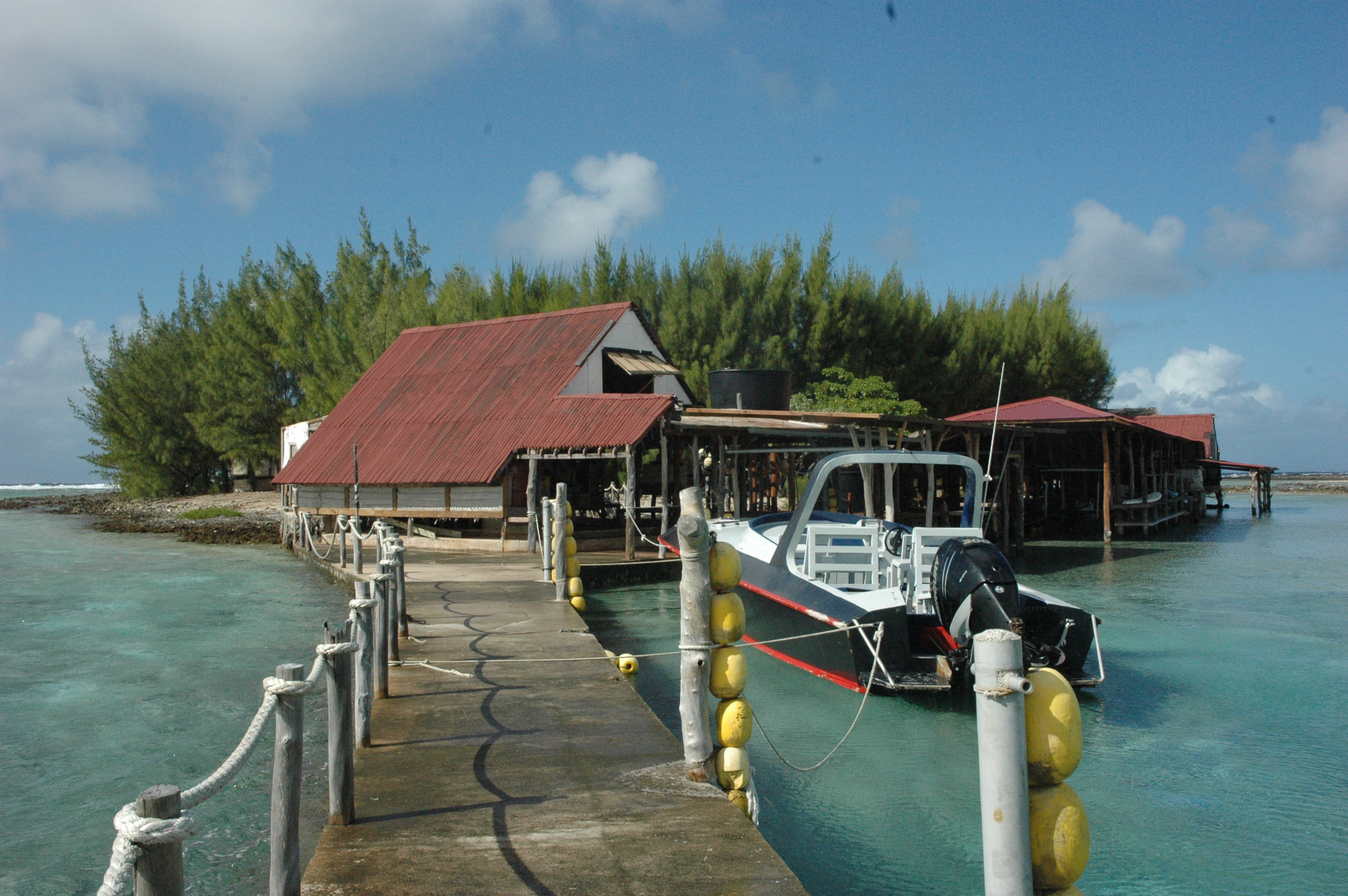
The Fakarava Municipality Biosphere Reserve is located in French Polynesia, in the Tuamotu Archipelago, 360 kilometres northeast of Tahiti Island.
It is formed by 7 low islands of coral or atoll origin: Aratika, Fakarava, Kauehi, Niau, Raraka, Taiaro, and Toau. These atolls are very different from each other in size, shape, openness to the ocean, population and activities. Its character is unique: there are small closed lagoons such as those of Taiaro and Niau, the former being over-salted while the latter is brackish. And large lagoons open to the ocean such as Fakarava, which has the largest pass in French Polynesia 1,600 metres wide.
 Coral formations, marine phanerogamous meadows, "kopara" ponds, primary forests in "puatea" (Pisonia grandis), coconut groves, and other plant formations characteristic of the atolls of French Polynesia, offer a great diversity of landscapes.
The fauna and flora are remarkable, with rare, protected and endemic species. Let us mention the kingfisher or "koteuteu" (Todiramphus gambieri niauensis), an animal species that is strictly endemic to the Niau atoll.
The cultural heritage is also rich, containing many archaeological remains such as marae, ancient culture pits or maita, legends, etc.
By joining a recognised international network, the municipality and the inhabitants of Fakarava commune wish to have the importance they attach to the preservation and enhancement of their rich natural and cultural heritage, inherited from their ancestor, acknowledged. They also undertake to promote the sustainable development of the islands, in particular tourism and the exploitation of the natural resources on which they depend.
In the heart of the Caribbean arc, the Guadeloupe Archipelago Biosphere Reserve encompasses the Basse Terre and almost entirely the Grande Terre. The Basse Terre is home to the Soufrière volcanic mountain range, surrounded by a tropical rainforest with high biodiversity.
The inlet of the Salt River separates it from the Grande Terre, a low-lying limestone formation. To the north, between the two islands, the bay of Grand Cul-de-Sac Marin conceals mangroves, swampy freshwater forests and wet meadows. Its marine parts are made up of herbaria and coral reefs. The marine parts of the Biosphere Reserve are populated by many species, including cetaceans. Some islets (Pigeons, Cashews, Kahouanne, English Head etc.) are also part of it.
 The richness of the cultural heritage is illustrated through local customs and knowledge but also by marked artistic specificities. This wealth is imprinted with the strong events in the history of Guadeloupe such as the presence of Amerindian civilizations or the era of slavery.
Designated by UNESCO in 1988, the Islands and Iroise Sea Biosphere Reserve promotes the sustainable economic and social development of its territory, preserving its rich natural and cultural heritage and encouraging scientific research and environmental education.
 The main ecosystems of the Atlantic biogeographical domain (island, coastal and marine) are represented: the marine environment, the foreshore, the cliffs with Atlantic coastal vegetation, the moors, the meadows.
On land and at sea, island communities have developed and maintained an original culture. Its exceptional landscapes and biodiversity make it a privileged destination for research, tourism and artistic creation.
The territory, the municipalities and all its actors are at the heart of the project and invite visitors to discover this remarkable environment!
The Dordogne River runs through a remarkable territory thanks to its preserved nature, its exceptional cultural heritage and an art of living marked by the river's imprint. The economy of its basin, which is largely touristic, agricultural and forestry but also industrial, benefits from the natural resources, the beauty of the landscapes and the brand image provided by the Dordogne River and its many affluents.
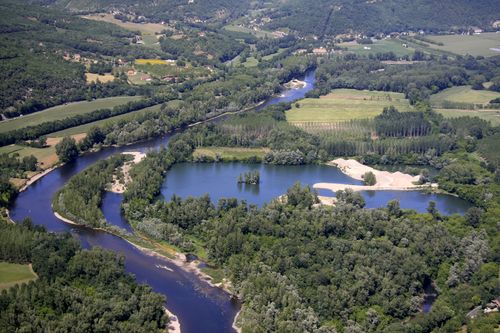 Maintaining the symbiosis between nature and man that characterizes the Dordogne basin is a collective and individual, daily and long-term responsibility. Preserving the river heritage of the Dordogne basin, the resources and benefits it provides is a prerequisite for the future development of this territory.
The Dordogne Basin World Biosphere Reserve must promote the imagination and energy of the region's stakeholders to ensure that it is part of a sustainable process of progress in which taking the environment into account is seen as an opportunity and an advantage.
The Audomarois marsh is located at the junction between the Artois and Flanders. Vast of 3726 ha, rich of 700 km of canals, picturesque landscapes, 300 species of plants including 40 protected by law, more than 200 species of birds, 26 species of fish, it is truly a privileged site.
However, modern farming techniques and new social practices threaten this unique area, the only cultivated marsh in France.
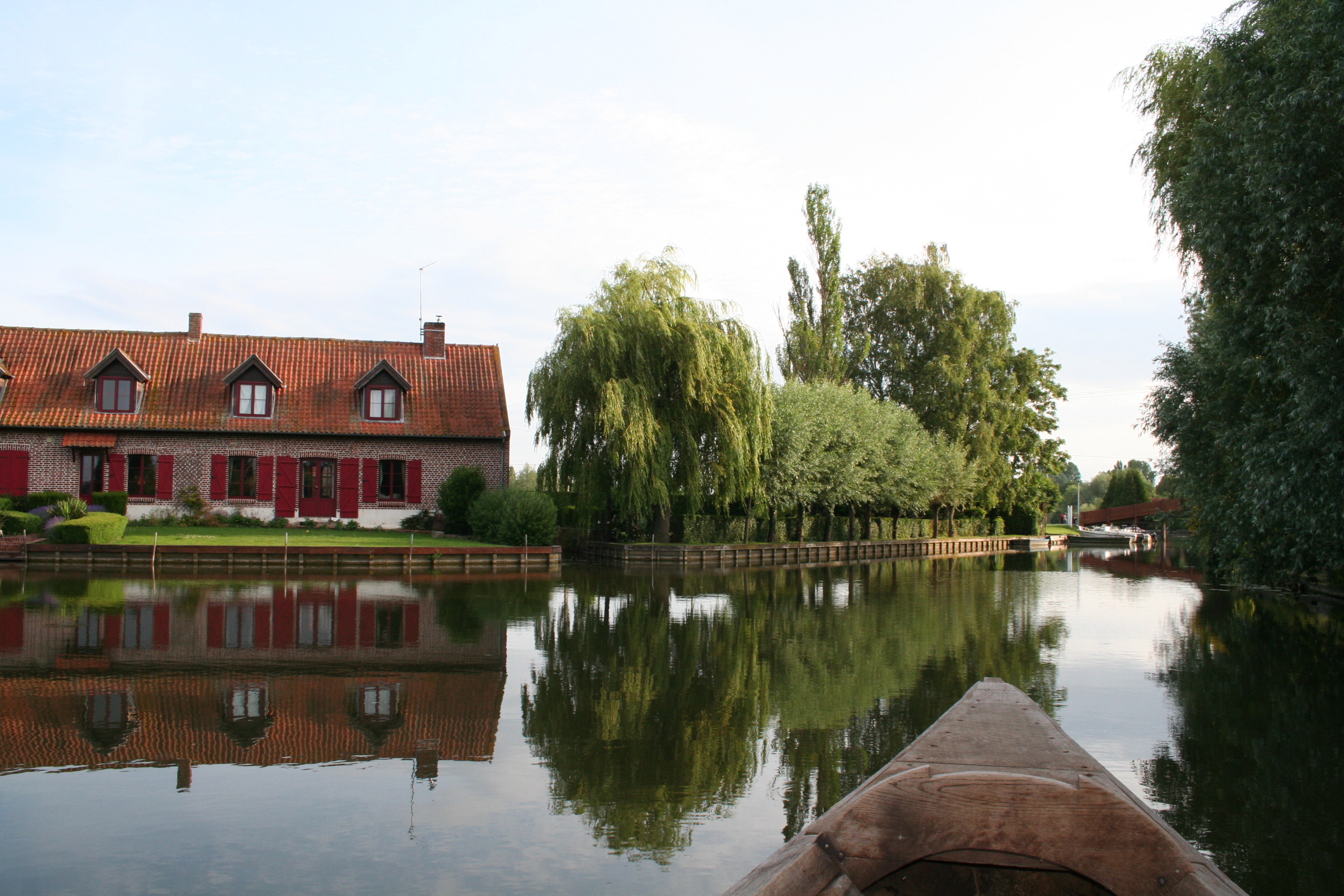 Local actors considered it their responsibility to take charge of the future of this exceptional area in order to ensure its preservation and transmission under good and safe conditions to future generations.
For more than 10 years, their commitment has been demonstrated by concrete actions of restoration, enhancement and education. Two objective documents have already been published and have exceeded expectations in terms of positive benefits for the territory. In particular, the increasing participation of local associations, partners and inhabitants, but also recognition beyond our borders, such as the Ramsar site and the Biosphere Reserve, constitute important awards and recognition of the specific features of the territory and our work.
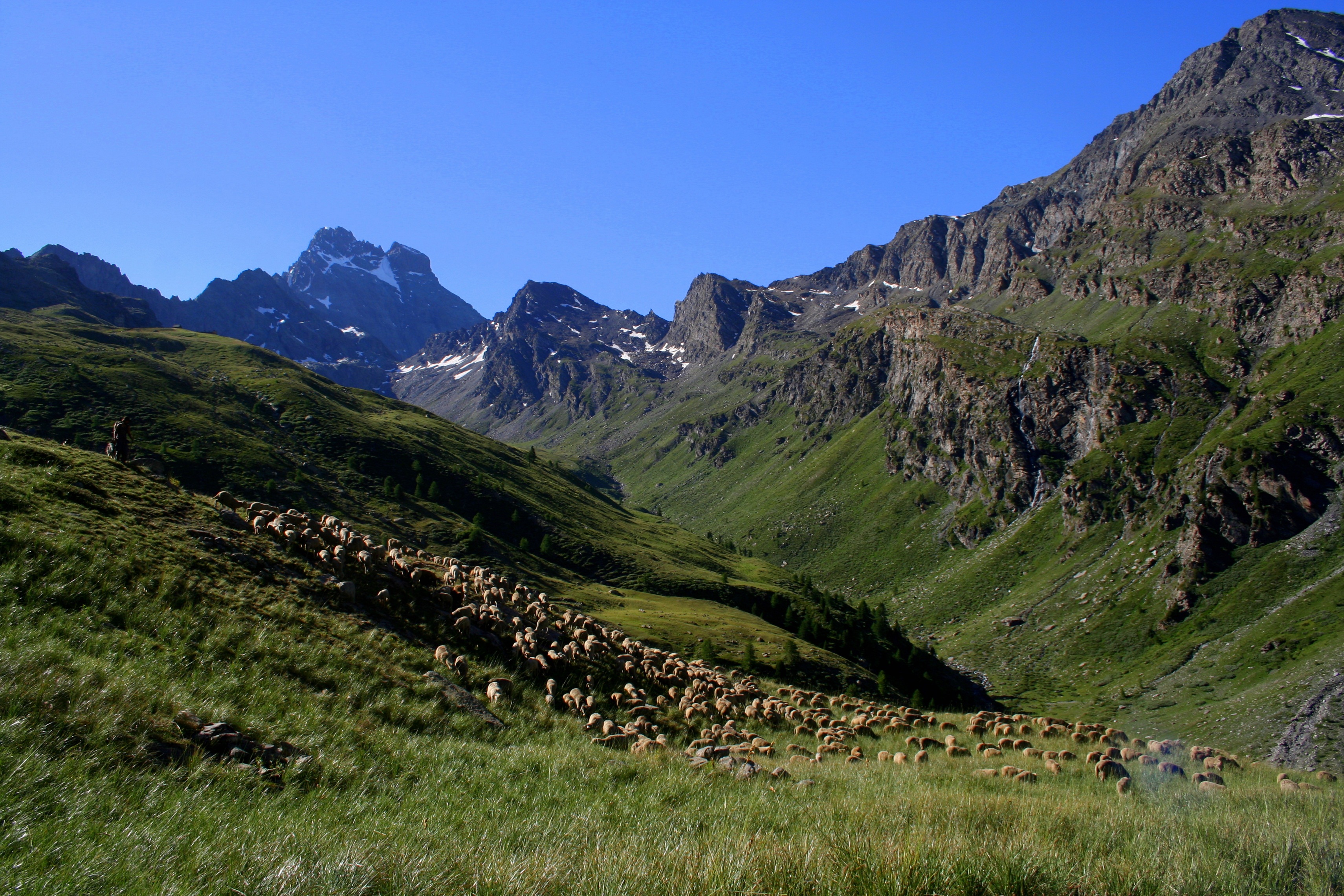
The French territory of the Mont Viso Biosphere Reserve, composed of small towns and perched villages, surrounded by peaks reaching more than 3000 m, is located in medium and high mountain areas. Access is limited due to its geographical characteristics: gorges, peaks, winding roads, remote valleys. This difficulty of access allows it to promote its natural resources, as evidenced by the continuum of Franco-Italian natural spaces, its culture and its expertise. Thus, over the years, the orientations and choices of the resident populations have helped to promote a remarkable living and working environment, close to the natural environment that has always been preserved.
 Several organisations are at the heart of land management (State with Natura 2000, Countries, Communities of Municipalities, Regional Nature Parks) in order to promote sustainable development. Their actions are mainly focused on the dialogue of stakeholders on the major issues of the territory with the objectives of social equity, the development and sustainability of the economy and the preservation of the environment.
It took ten years to reach the designation of the Biosphere Reserve. This idea of enhancing and having UNESCO recognize this historical cooperation has been a real motivation for many Franco-Italian projects in scientific, ecological, economic, social and cultural terms. The potential of a transboundary biosphere reserve has found, through these initiatives, a real meaning for the actors of the territory.
The Mont-Viso Biosphere Reserve is home to rare and specific natural and heritage resources that have been maintained and conserved by the men and women who have lived from it over the millennia and to whom they are very attached.
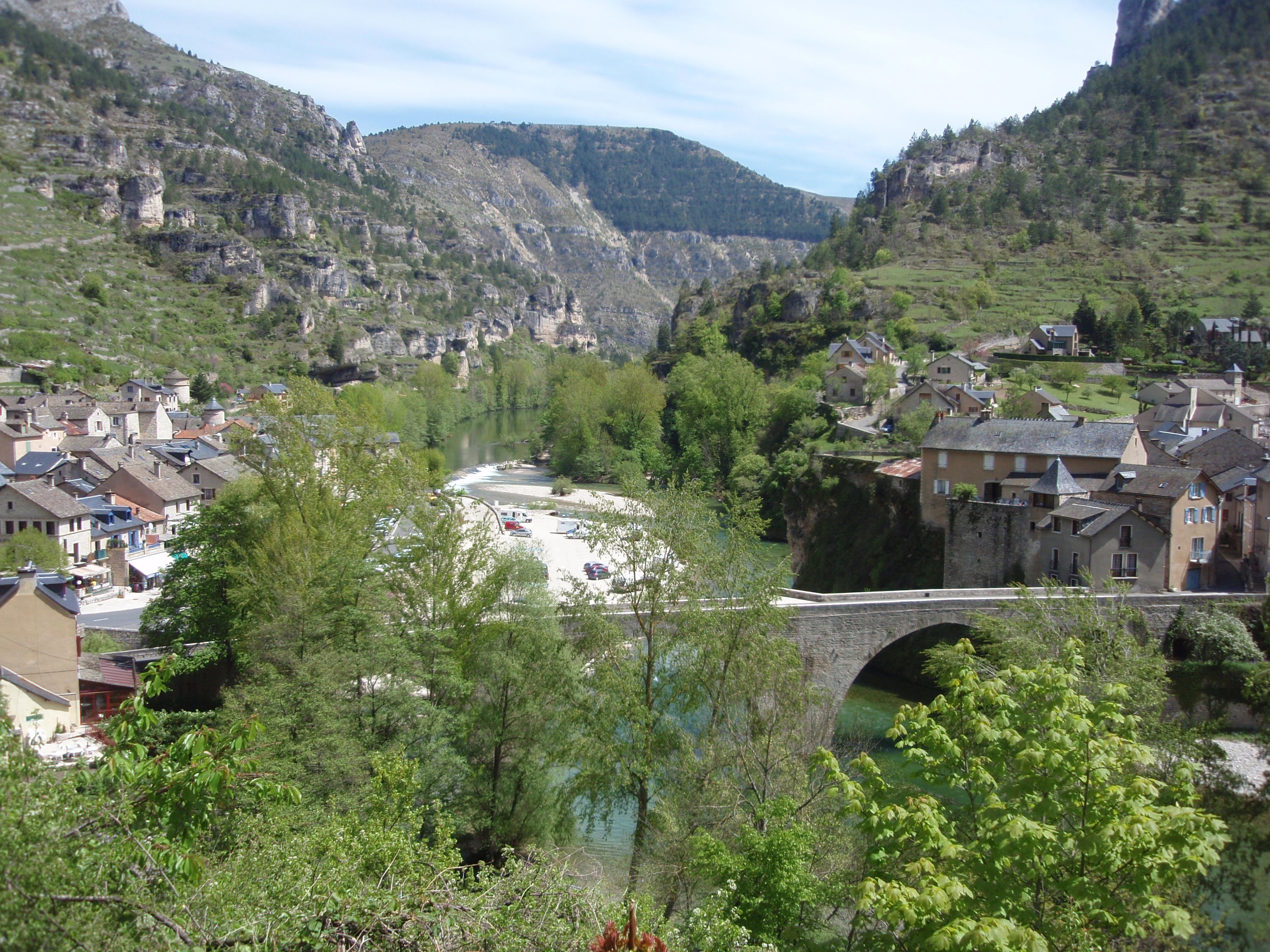
Within the limestone plateaus of Languedoc, the Gardon has carved its gorges over some thirty kilometres wandering through the Mediterranean landscape of the Uzège. Named after the Gard department, the river was born in the Cévennes valleys. It then crosses the Gardonnenque plain, the karst massif north of Nîmes and ends its journey by flowing into the Rhône.
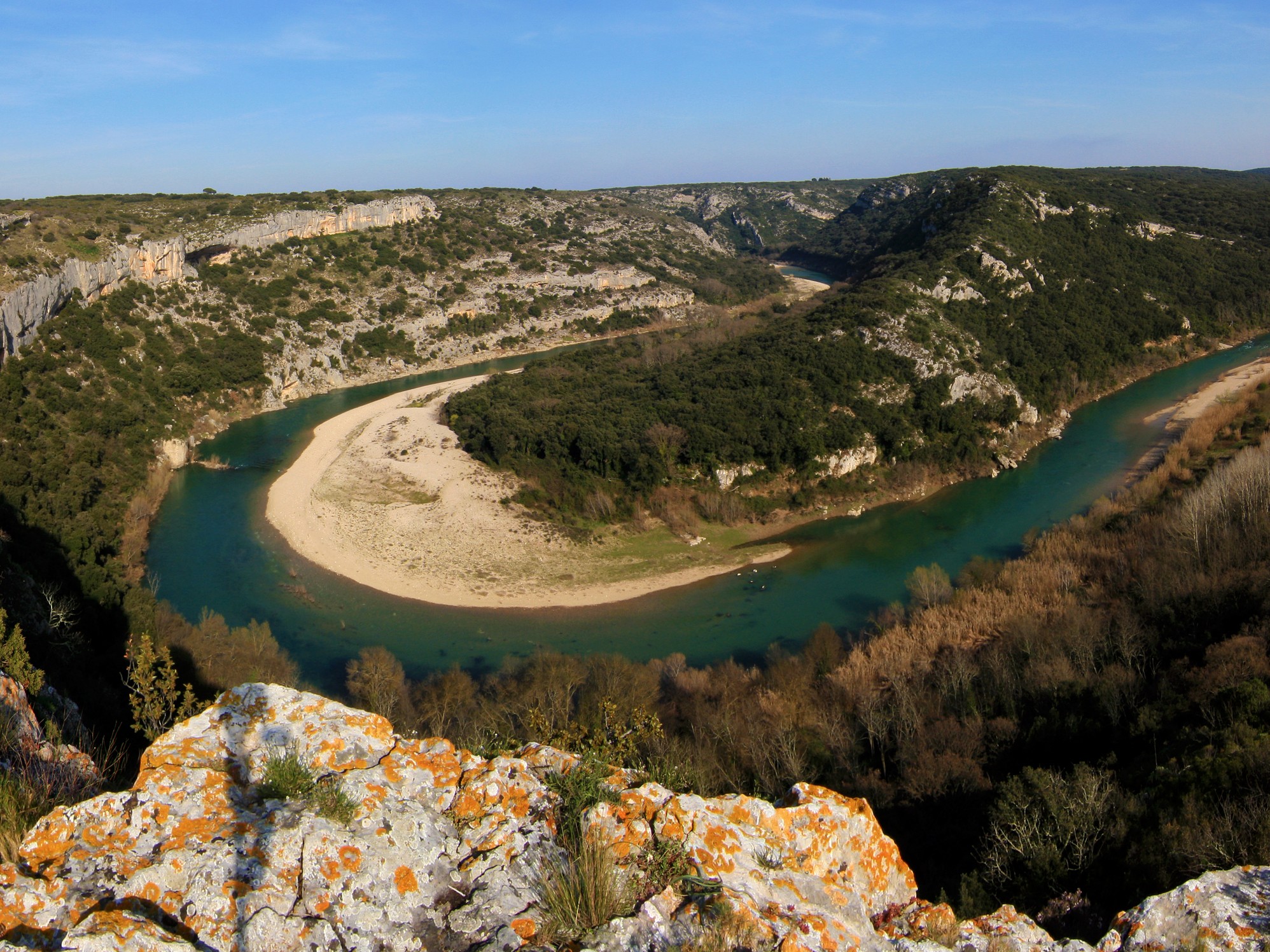 The Gardon Gorges Biosphere Reserve covers more than 45,000 hectares, combining garrigues, agricultural plains and oak forests, bordered by an urban area of more than 250,000 inhabitants.
The Gorges du Gardon are a biodiversity hotspot whose preservation the public authorities wished to guarantee by introducing various legislative measures in the 1980s, such as the classification of the site according to the law of 2 May 1930 and a part of it as a Regional Nature Reserve.